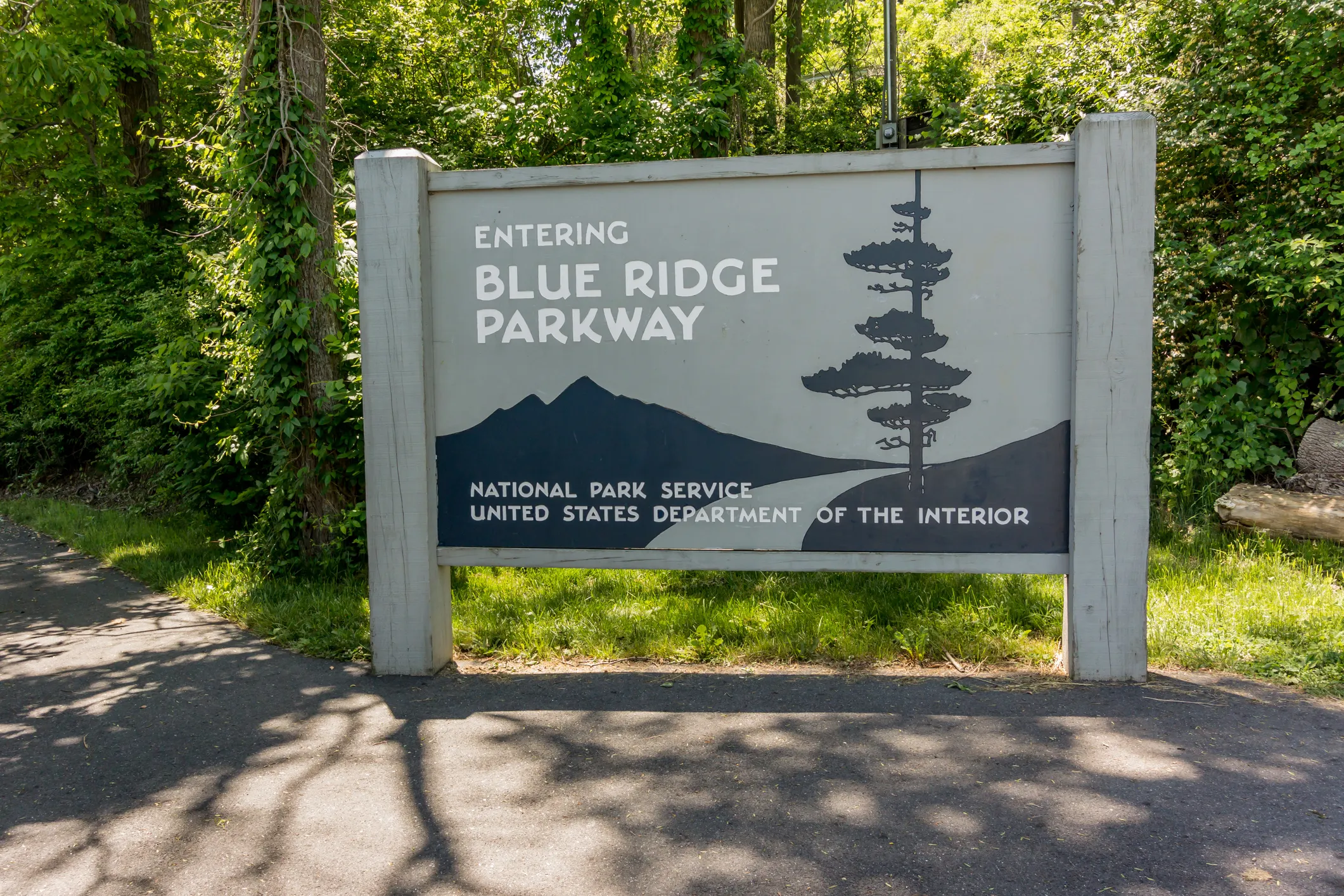
The Blue Ridge Parkway stands as America's most beloved scenic highway, winding 469 miles through the Appalachian Mountains from Virginia's Shenandoah National Park to North Carolina's Great Smoky Mountains. This engineering marvel attracts over 15 million visitors annually, making it the most visited unit in the National Park System.
However, the Parkway's mountain elevation and varied microclimates create unique challenges that catch unprepared travelers off guard. From sudden fog banks that reduce visibility to zero, to elevation-related weather changes that can shift from sunny and warm to cold and rainy within minutes, successful Blue Ridge Parkway travel requires more than just pointing your vehicle south.
This comprehensive guide reveals insider strategies for timing your visit, navigating weather challenges, discovering hidden gems, and maximizing your Blue Ridge Parkway experience while staying safe on one of America's most weather-sensitive highways.

What Makes the Blue Ridge Parkway America's Premier Scenic Highway?
The Blue Ridge Parkway is a 469-mile scenic highway connecting Shenandoah and Great Smoky Mountains National Parks, designed exclusively for leisurely travel through the Appalachian Mountains. Unlike interstate highways built for speed and efficiency, the Parkway was conceived as a "museum road" where the journey itself serves as the primary attraction.
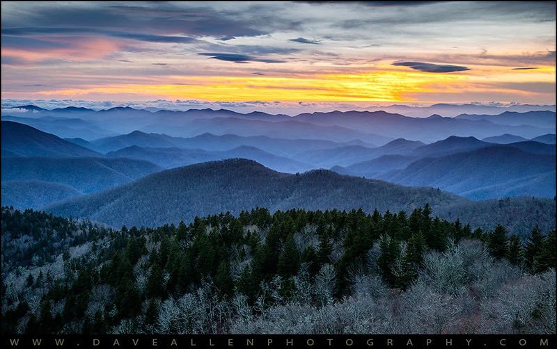
Completed in 1987 after 52 years of construction, the Parkway maintains a maximum speed limit of 45 mph and prohibits commercial traffic, creating an unhurried driving experience through diverse ecosystems spanning two states. The route crosses elevations from 649 feet to 6,053 feet at Richland Balsam, offering dramatic climate variations and scenic diversity unmatched by any other American highway.
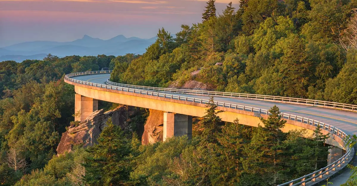
The Parkway's unique design philosophy prioritizes scenic beauty over practical transportation, featuring 26 tunnels, 168 bridges, and hundreds of scenic overlooks positioned to showcase the region's natural splendor. This commitment to preserving mountain vistas and forest corridors creates an immersive experience that transforms driving from transportation into recreation.
How Do Seasonal Changes Transform the Blue Ridge Parkway Experience?
Spring Awakening: March Through May
Spring along the Blue Ridge Parkway unfolds as a gradual wave of renewal, with lower elevations greening weeks before higher mountain areas. This elevation-dependent timing creates a unique phenomenon where travelers can experience multiple seasons within a single day's drive.
Peak spring experiences:
- Wildflower blooms beginning in March at lower elevations
- Waterfalls at maximum flow from spring snowmelt and rainfall
- Moderate temperatures ideal for hiking and outdoor activities
- Fewer crowds compared to peak summer and fall seasons
Spring weather considerations: Unpredictable mountain weather patterns dominate spring travel, with rapid temperature swings and frequent precipitation. Morning frost at higher elevations can occur through May, while afternoon thunderstorms develop regularly across the region.
Summer Splendor: June Through August
Summer transforms the Parkway into a lush green corridor offering relief from lowland heat and humidity. Higher elevations provide natural air conditioning, with temperatures typically 10-15 degrees cooler than surrounding valleys.

Summer highlights include:
- Full canopy coverage creating natural tunnels of green
- Extended daylight hours maximizing scenic driving time
- Peak accessibility with all facilities and most trails open
- Abundant wildlife activity during cooler morning and evening hours
Summer challenges: Afternoon thunderstorms develop regularly, especially at higher elevations, creating dangerous driving conditions with heavy rain, lightning, and reduced visibility. Weekend and holiday traffic can create significant congestion at popular overlooks and attractions.
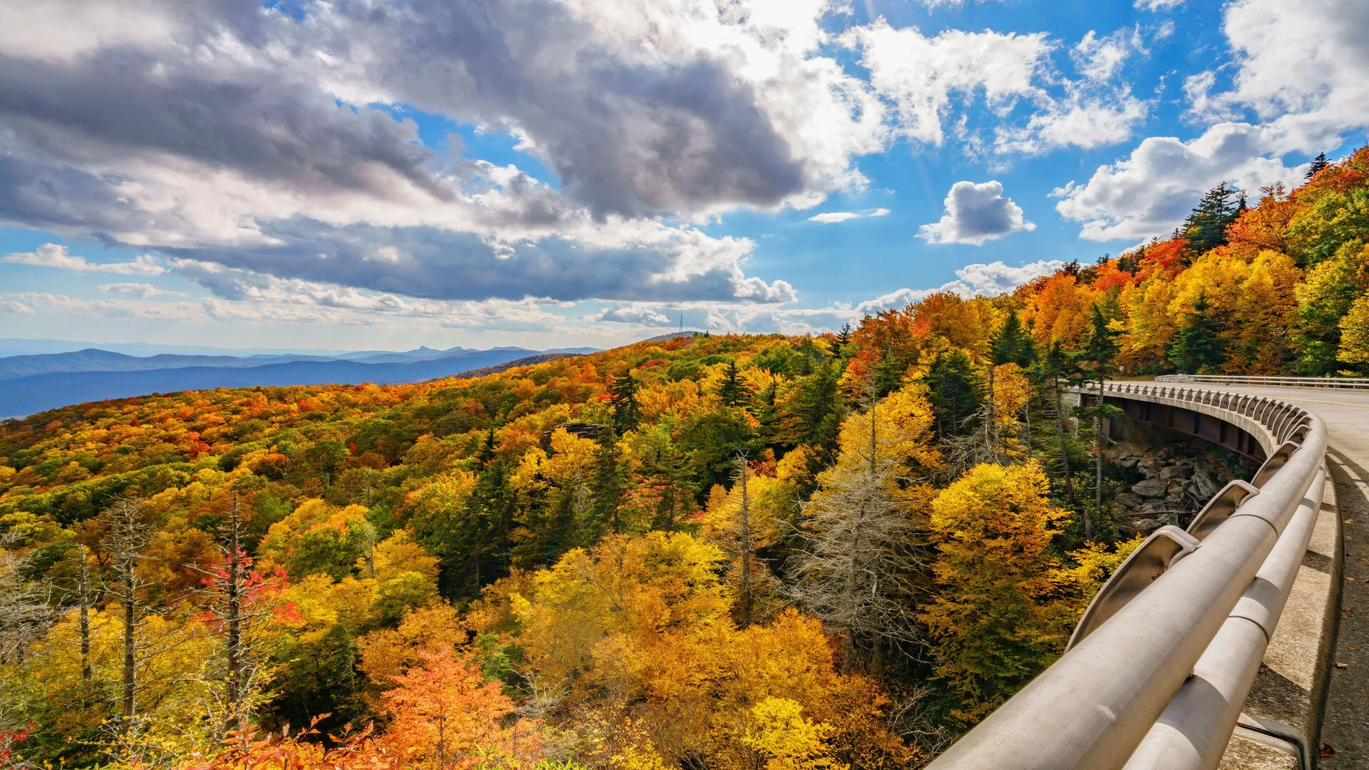
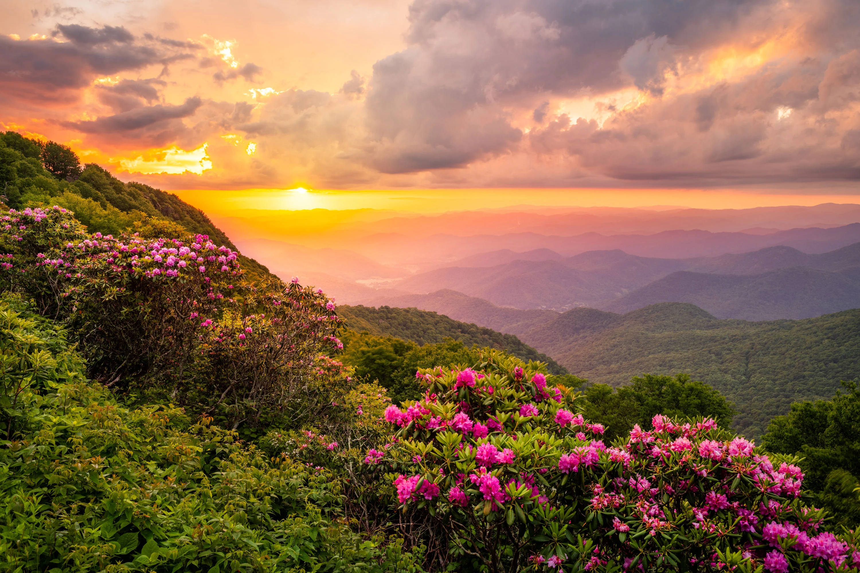
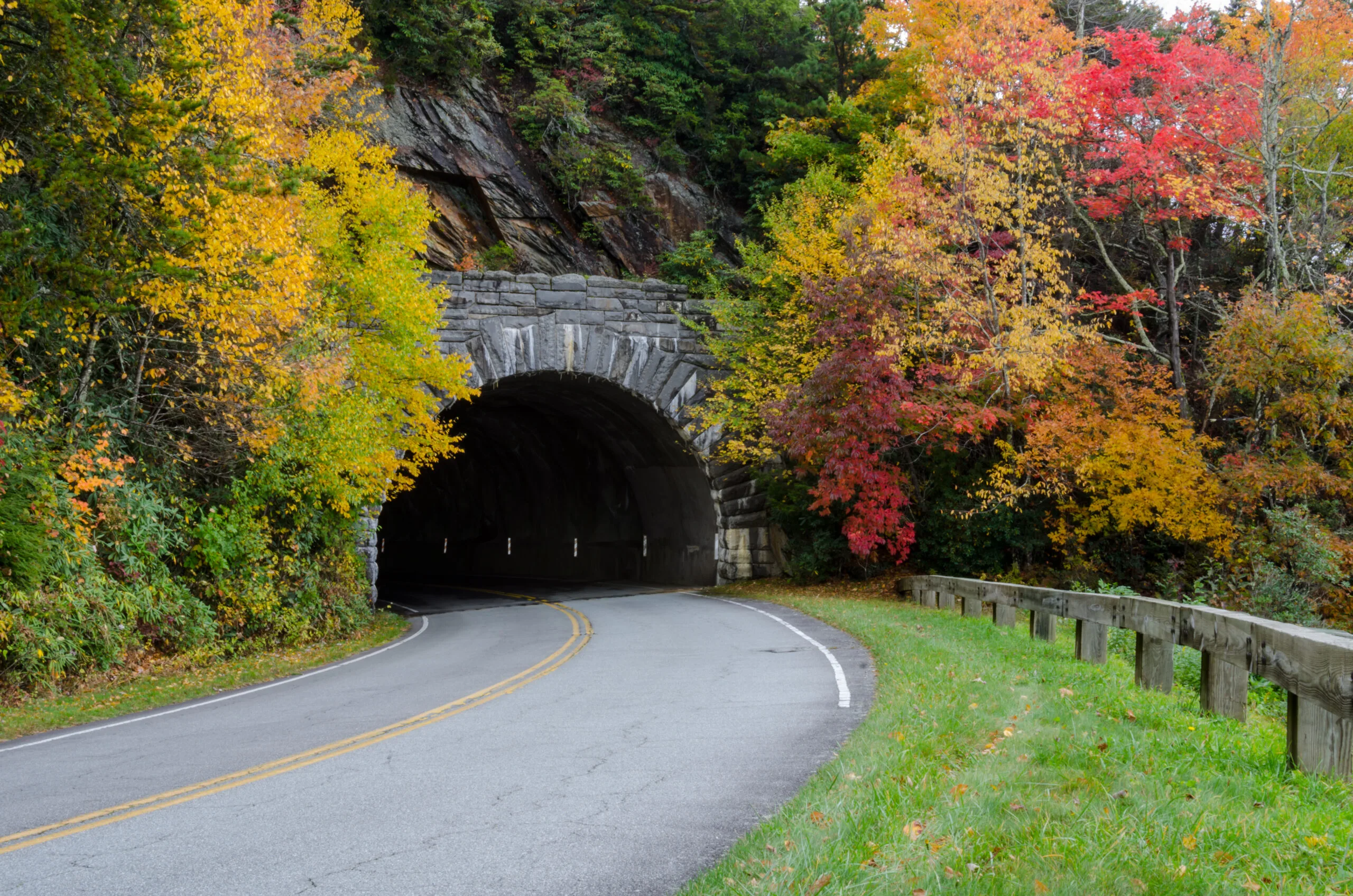
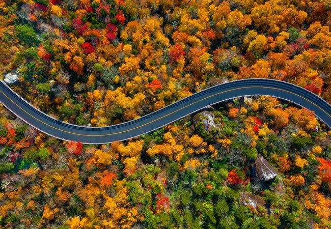
Autumn Glory: September Through November
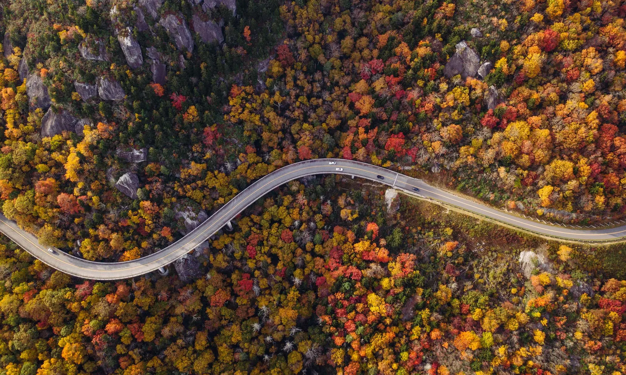
Fall represents the Parkway's most famous season, when mountainsides explode in brilliant displays of red, orange, and gold foliage. This spectacle draws millions of visitors, creating both incredible beauty and significant crowds.
Fall foliage timing:
- Late September: Higher elevations (above 4,000 feet) begin changing
- Early October: Peak color at elevations above 3,000 feet
- Mid-October: Peak color at middle elevations (2,000-3,000 feet)
- Late October: Peak color at lower elevations (below 2,000 feet)
Real-world example: In October 2023, unseasonably warm temperatures delayed peak foliage by 2-3 weeks across the central Parkway, catching many visitors who planned trips based on historical averages. Weather patterns increasingly affect traditional foliage timing.
Winter Serenity: December Through February
Winter reveals the Parkway's quieter character, with snow-covered peaks and dramatic mountain vistas unobscured by foliage. However, weather conditions create significant access challenges that require careful planning.
Winter considerations:
- Frequent road closures due to ice and snow at higher elevations
- Limited facility operations and reduced services
- Spectacular views and photography opportunities in clear weather
- Dangerous driving conditions requiring winter driving experience
What Are the Blue Ridge Parkway's Must-See Destinations and Hidden Gems?
Northern Section: Virginia Shenandoah to Roanoke (Mile 0-120)
The northern Parkway section offers gentle introduction to mountain driving with moderate elevations and well-developed visitor facilities. This region combines historical significance with natural beauty, featuring Civil War battlefields and Virginia's wine country.
Key destinations:
- Humpback Rocks (Mile 5.8): Short hike to panoramic views and reconstructed 1890s farm
- Crabtree Falls (Mile 27.2): Virginia's highest waterfall accessible via moderate 3-mile hike
- Natural Bridge State Park (Mile 63.1): Geological wonder carved by Cedar Creek over millennia
- Peaks of Otter (Mile 86): Historic lodge and visitor center with lake reflections of surrounding peaks
Hidden gem: Love Gap (Mile 6) offers spectacular sunrise photography opportunities with minimal crowds, providing panoramic views across the Shenandoah Valley that rival more famous overlooks.
Central Section: Roanoke to Asheville (Mile 120-384)
The Parkway's central section presents its most challenging driving with higher elevations, sharper curves, and more dramatic weather variations. This region rewards adventurous travelers with stunning mountain vistas and diverse ecosystems.

Premier attractions:
- Mabry Mill (Mile 176.1): Most photographed structure on the Parkway, featuring working gristmill and blacksmith shop
- Rough Ridge (Mile 302.8): Accessible boardwalk leading to spectacular 360-degree mountain views
- Linville Falls (Mile 316.4): Multiple viewing platforms showcasing powerful waterfall from different perspectives
- Grandfather Mountain (Mile 305.1): Private attraction featuring mile-high swinging bridge and wildlife habitats
Insider tip: Mount Craig Trail (Mile 355.4) provides access to North Carolina's second-highest peak via moderate 1-mile hike, offering views typically reserved for experienced mountaineers.
Southern Section: Asheville to Cherokee (Mile 384-469)
The southern Parkway culminates in the highest elevations and most dramatic scenery, transitioning from deciduous forests to spruce-fir ecosystems reminiscent of Canadian wilderness.
Signature experiences:
- Craggy Pinnacle (Mile 364.4): Easy hike to 360-degree views from exposed summit
- Mount Mitchell State Park (Mile 355.4): Highest peak east of Mississippi River with observation tower
- Richland Balsam (Mile 431): Highest point on Parkway accessible by short trail through unique ecosystem
- Waterrock Knob (Mile 451.2): Moderate climb to panoramic views of surrounding peaks
Hidden treasure: Looking Glass Rock Overlook (Mile 417) provides dramatic views of the massive granite dome without the crowds of more publicized viewing areas.
How Should You Plan Your Blue Ridge Parkway Route Based on Weather Patterns?
Optimal Weather Windows for Different Activities
Weather timing significantly impacts Blue Ridge Parkway experiences, with mountain elevation creating microclimates that can vary dramatically within short distances. Understanding these patterns allows travelers to maximize favorable conditions while avoiding dangerous weather scenarios.
Photography and sightseeing optimal conditions:
- Early morning (6-9 AM): Clear air, soft lighting, minimal crowds
- Late afternoon (4-7 PM): Dramatic lighting, enhanced colors, comfortable temperatures
- Post-storm periods: Crystal-clear air providing maximum visibility and vibrant colors
Hiking and outdoor activities:
- Spring and fall mornings: Moderate temperatures, stable weather patterns
- Summer early morning/evening: Avoiding afternoon thunderstorm development
- Winter clear days: Spectacular views but requiring proper cold-weather preparation
Weather-Related Safety Considerations
Mountain weather develops rapidly and can create dangerous driving conditions within minutes. The Parkway's narrow, winding design amplifies weather-related risks, particularly for inexperienced mountain drivers.
Critical weather hazards:
- Sudden fog development: Common at higher elevations, reducing visibility to near zero
- Afternoon thunderstorms: Frequent in summer, creating hydroplaning conditions and lightning strikes
- Ice formation: Occurs at elevations above 3,000 feet when valley temperatures remain above freezing
- High winds: Exposed overlooks and ridge sections experience gusts exceeding 60 mph during storms
Professional driver insights: Commercial tour operators avoid Parkway travel during fog advisories and postpone trips when weather forecasts indicate afternoon thunderstorm development above 70% probability.
Blue Ridge Parkway Seasonal Comparison: Planning Your Perfect Visit
| Season | Weather Conditions | Scenic Highlights | Crowd Levels | Road Conditions | Best For |
|---|---|---|---|---|---|
| Spring | Variable, cool mornings | Waterfalls, wildflowers | Low-Medium | Occasional closures | Photography, hiking |
| Summer | Warm days, afternoon storms | Lush greenery, wildlife | High | Generally clear | Family travel, camping |
| Fall | Cool, crisp, variable | Peak foliage colors | Very High | Generally clear | Scenic driving, photography |
| Winter | Cold, snow/ice possible | Snow-capped peaks, clear views | Low | Frequent closures | Solitude, winter photography |
What Essential Services and Amenities Are Available Along the Parkway?
Lodging Options and Recommendations
The Blue Ridge Parkway offers limited lodging directly on the route, requiring advance planning for overnight stays. Most accommodations cluster around gateway communities providing access to Parkway segments.

On-Parkway lodging:
- Peaks of Otter Lodge (Mile 86): Historic lakeside lodge offering mountain views and restaurant dining
- Pisgah Inn (Mile 408.6): Mountain lodge with restaurant and spectacular valley overlooks
- Rocky Knob Cabins (Mile 174): Rustic cabins providing secluded mountain experience
Gateway community options:
- Waynesboro, VA: Northern gateway with extensive hotel and restaurant options
- Asheville, NC: Major city with diverse accommodations from budget to luxury
- Cherokee, NC: Southern gateway providing access to Great Smoky Mountains
Dining and Supply Considerations
Food service along the Parkway remains limited, with significant gaps between restaurants and grocery stores. Successful Parkway travel requires planning meal stops and carrying emergency supplies.
On-Parkway dining locations:
- Peaks of Otter Restaurant (Mile 86)
- Mabry Mill Restaurant (Mile 176.1)
- Pisgah Inn Restaurant (Mile 408.6)
Supply strategy: Stock up on snacks, water, and emergency supplies in gateway communities before beginning Parkway segments. Gas stations appear infrequently, requiring fuel planning for longer driving segments.
Essential Blue Ridge Parkway Travel Tips from Local Experts
Vehicle Preparation and Safety:
- Check brakes and transmission cooling systems before mountain driving
- Carry emergency supplies including water, snacks, and warm clothing
- Maintain half-tank minimum fuel level due to limited gas stations
- Test headlights and ensure proper tire tread for mountain driving conditions
- Download offline maps as cell service remains spotty throughout the route
Photography and Sightseeing Strategy:
- Start early to capture optimal lighting and avoid crowds at popular overlooks
- Research specific sunrise/sunset times for planned photography locations
- Allow extra time for spontaneous stops at unmarked scenic viewpoints
- Bring layers of clothing as temperatures vary significantly with elevation
- Check weather forecasts for clear visibility windows at high-elevation destinations
Traffic and Timing Optimization:
- Avoid weekend travel during peak fall foliage season (October 1-20)
- Plan alternative routes for accessing Parkway during high-traffic periods
- Use early morning and late afternoon travel windows for optimal experiences
- Build flexibility into schedules for weather delays and spontaneous exploration
- Consider mid-week travel for significantly reduced crowds and traffic
Frequently Asked Questions
Q: How long does it take to drive the entire Blue Ridge Parkway?
Driving the entire 469-mile Parkway requires 8-10 hours of continuous driving time, but most visitors spend 3-5 days to properly experience the scenic overlooks, hiking trails, and attractions. The 45 mph speed limit and frequent stops for sightseeing significantly extend travel time beyond basic driving duration.
Q: What's the best time of year to visit for avoiding crowds while still experiencing good weather?
Late spring (May) and early fall (September) offer the optimal balance of favorable weather and manageable crowds. These shoulder seasons provide comfortable temperatures, clear skies, and access to most facilities while avoiding peak summer and fall foliage crowds.
Q: Are there any sections of the Parkway that frequently close due to weather?
Yes, higher elevation sections above 4,000 feet close regularly during winter months due to ice and snow. The section between Asheville and Cherokee (Miles 384-469) experiences the most frequent closures, sometimes remaining closed for days or weeks during severe winter weather.
Q: Can RVs and large vehicles safely navigate the Blue Ridge Parkway?
The Parkway accommodates RVs up to 40 feet in length, though tight curves and steep grades create challenges for larger vehicles. Many tunnels have height restrictions, and some scenic overlooks cannot accommodate large RVs. Check specific restrictions before traveling with oversized vehicles.
Q: How can I get real-time information about road closures and weather conditions?
The National Park Service provides real-time closure information, while weather conditions are available through the National Weather Service. For comprehensive weather routing that considers mountain-specific conditions, use integrated planning tools that combine road status with detailed weather forecasts.
Conclusion: Master the Blue Ridge Parkway for Unforgettable Mountain Adventures
The Blue Ridge Parkway offers America's premier scenic driving experience, but success requires understanding its unique weather patterns, seasonal variations, and mountain driving challenges. By timing your visit appropriately, preparing for variable conditions, and utilizing insider knowledge about hidden gems and optimal viewing times, you can transform a simple drive into an extraordinary mountain adventure.
Remember that the Parkway's greatest beauty often emerges during transitional weather periods—after storms clear, during seasonal changes, and in the soft light of early morning hours. Flexibility in your travel plans allows you to capitalize on these magical moments while staying safe during challenging conditions.
The key to Blue Ridge Parkway mastery lies in respecting mountain weather, planning for variable conditions, and maintaining realistic expectations about travel times and accessibility. Professional guides consistently emphasize that the best Parkway experiences come to those who adapt their plans to current conditions rather than forcing predetermined schedules.
Ready to Plan Your Perfect Blue Ridge Parkway Adventure?
Transform your Blue Ridge Parkway journey from ordinary sightseeing into extraordinary mountain exploration. Plan your route with RoutePredict's comprehensive weather-integrated system that combines real-time weather data, Blue Ridge Parkway road closures, and scenic timing optimization—helping you decide when the Parkway offers the best route versus faster alternatives like I-81 or I-40 during adverse weather.
Don't let unpredictable mountain weather catch you off guard—explore our complete collection of destination planning resources that will help you experience America's favorite scenic drive at its absolute best, regardless of conditions.